Urban + : Zoning
As a part of this year’s Seattle Design Festival and in contribution to our hosted panel discussion called “Urban +: Adding Density while Retaining Character, b9 architects progressed on our research on Urban + by examining Seattle’s current zoning, explicitly looking at opportunities in Single-Family zones with Wallingford Residential Urban Village as our case study area.
Visit this page for updates post-panel discussion.
Seattle’s zoning code governs the use and development of land in Seattle.* It determines not only what and where types of structures can be built, but also the density of dwelling units and businesses throughout the city. Areas of more intensive development are focused in designated Urban Centers, Hub Urban Villages, and Residential Urban Villages. Wallingford and South Lake Union are two examples of these areas and generally walkable communities that are well served by amenities.
* Seattle.gov/dpd
Using data from the City of Seattle data portal, we examined Seattle’s current distribution of zoning by land area and dwelling units. In addition, we compared the current density, measured by number of units per acre of land, to the density assumptions determined by the city by zoning.*
*All data is derived form the City Of Seattle data portal at https://data.seattle.gov/. Specific files used for these calculations are; “City Of Seattle Zoning” (Updated 2018), “Zoning Density Assumptions For Zoned Development Capacity Model” (Updated 2017), and “Capacity For All Parcels 2015” (Updated 2017).
ZONING BY LAND AREA
Currently, nearly 65% of Seattle’s land area is reserved for Single-Family zoning. The next largest zone is Industrial at 12.0% of land area. These two zones present the lowest development potential for new dwelling units based on the Seattle’s zoning code.*

ZONING BY DWELLING UNITS
While over 75% of Seattle’s land area is dedicated to Single-Family and Industrial zoning, the majority of dwelling units (just over 60%) currently reside in other zones throughout the city, primarily Lowrise, Midrise, Highrise, and Neighborhood Commercial.*

With this information in mind, we then examined development opportunities in Single-Family zones, choosing the Wallingford neighborhood as a case study, due to the significant amount of Single-Family zoning in the neighborhood’s Residential Urban Village. Though a key goal of Seattle’s Urban Village Strategy is to “Increase residential and employment densities...” within its villages, Wallingford’s Residential Urban Village remains predominantly comprised of single-family homes, which accounts for between 50-75% of its total land use.
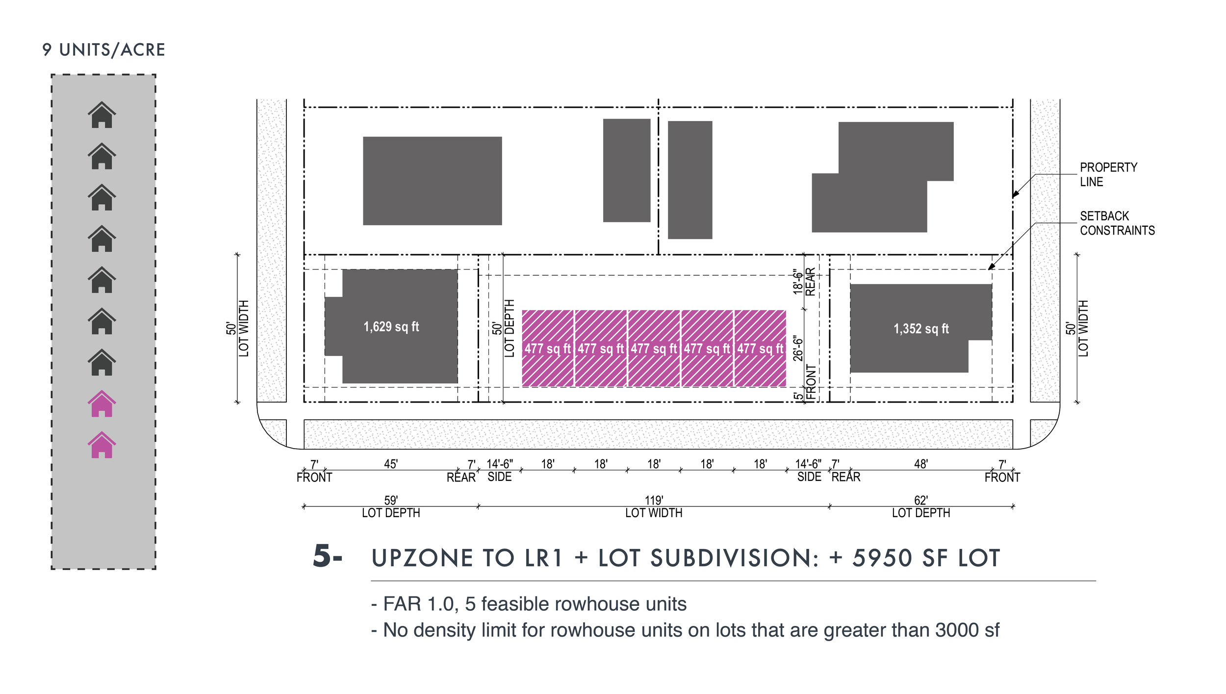
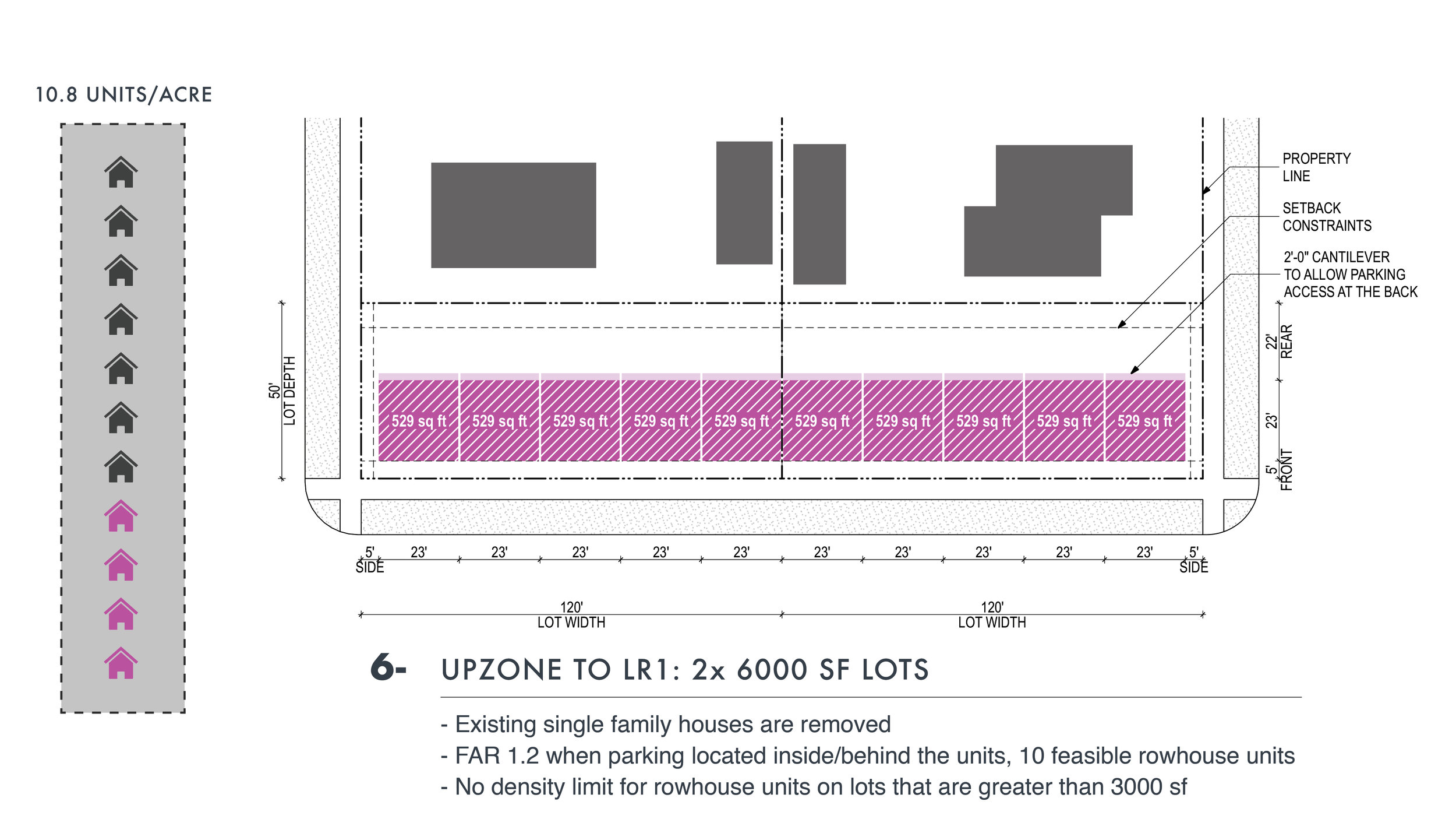
This research explores the possible densification benefits of re-thinking the ends of blocks. Examples here introduce a variety of block-end development solutions to the portions of the Wallingford Residential Urban Village currently zoned Single-Family Residential. This strategy suggests that units can be added to corner lots while the interior of residential blocks are allowed to retain their current residential fabric. Moreover, this strategy presents a possible incremental approach to densification upon implementation of MHA or similar up-zoning in the area. Precedents such as this, set in a neighborhood like Wallingford, can provide examples for strategic densification in other predominantly Single-Family neighborhoods throughout Seattle.
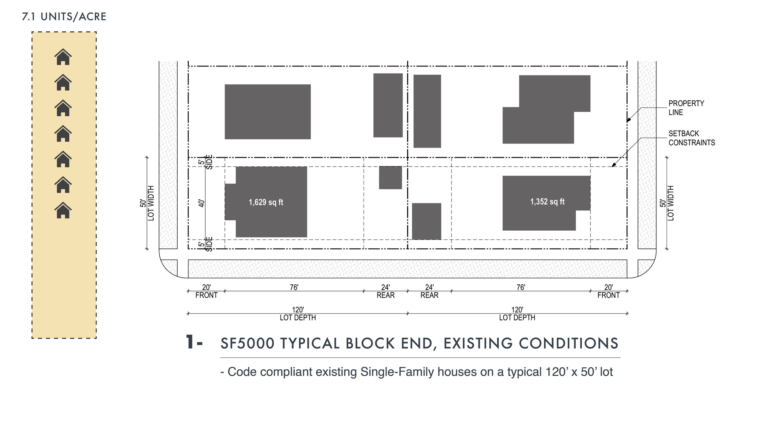
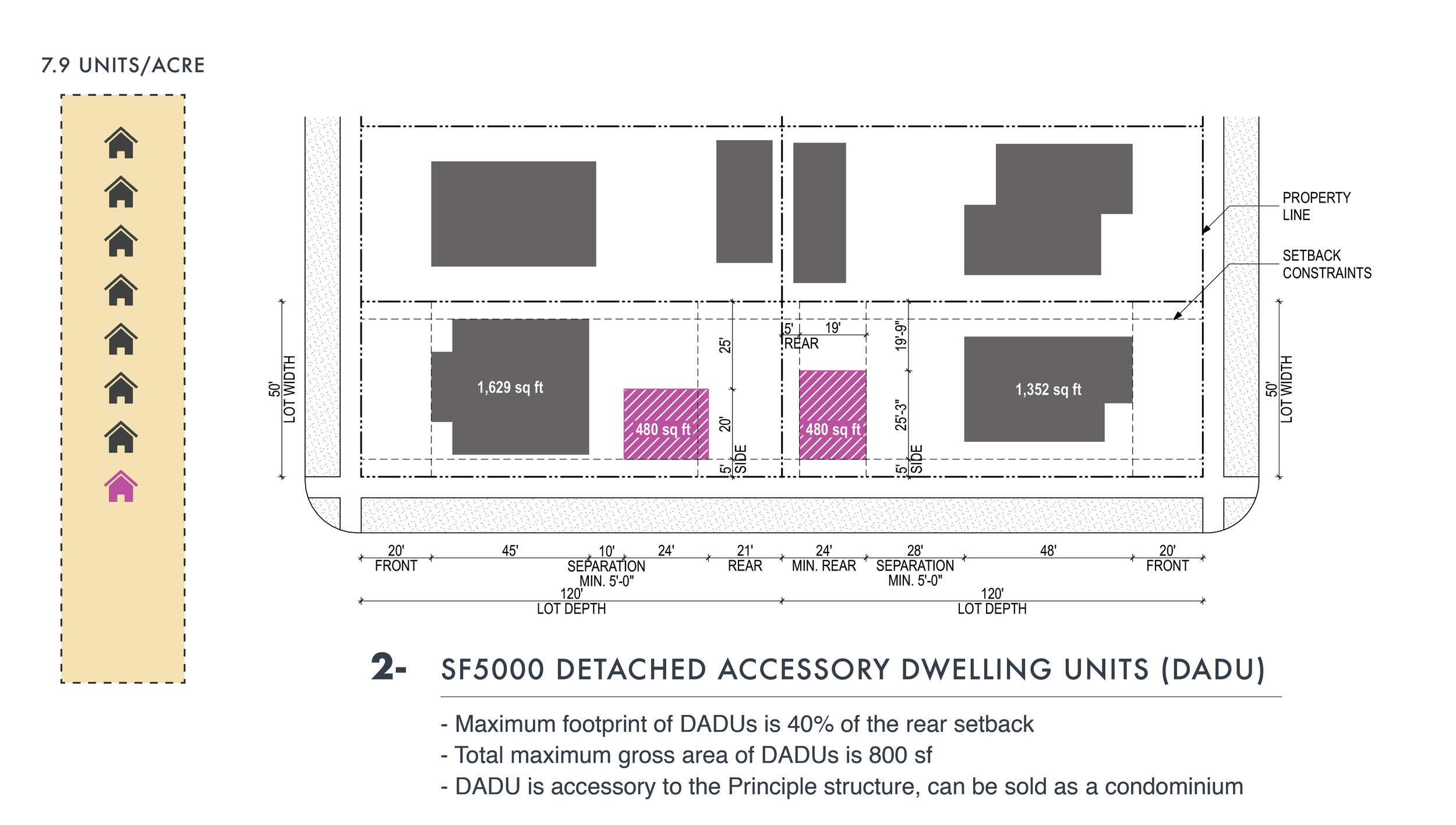
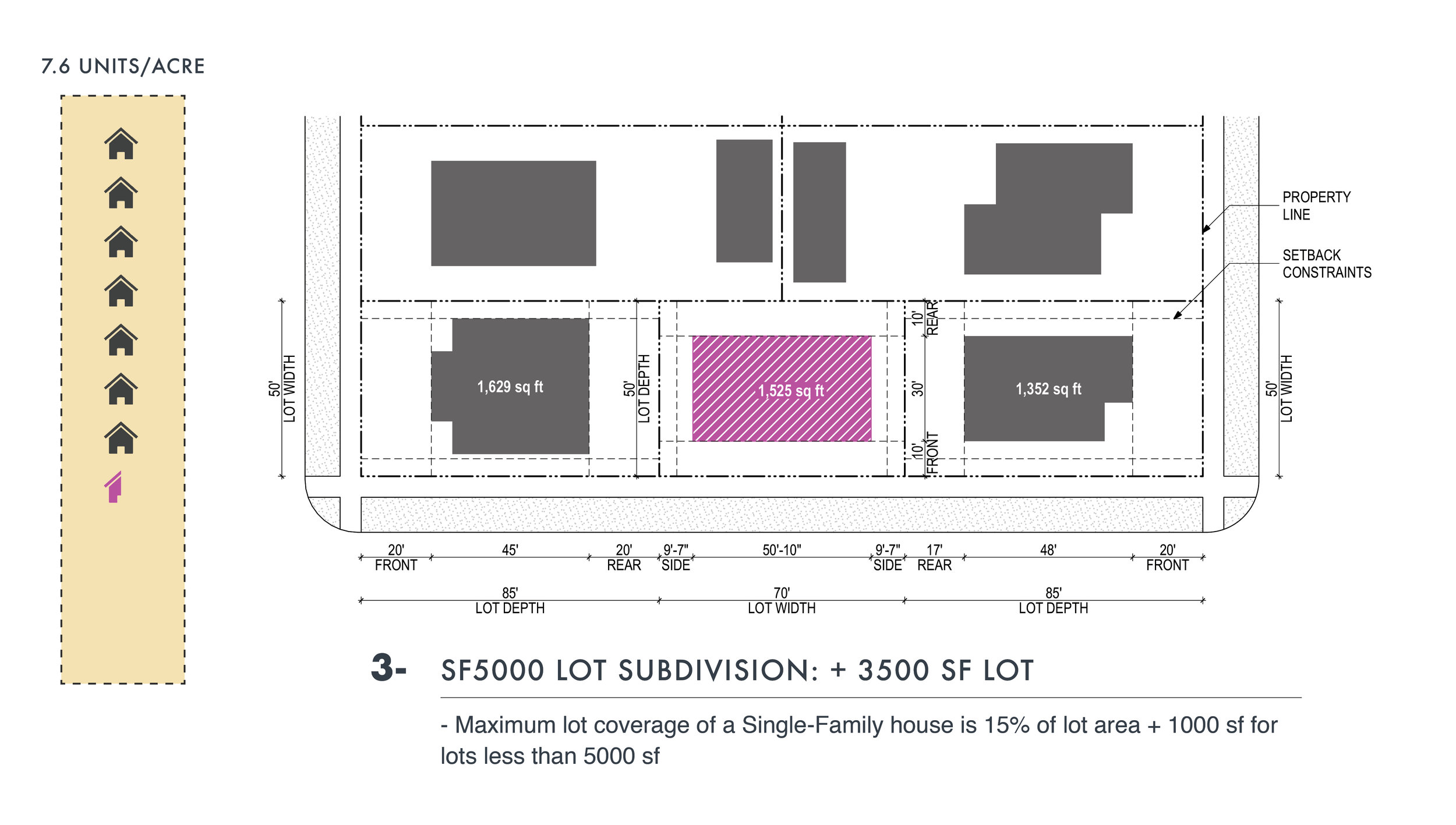
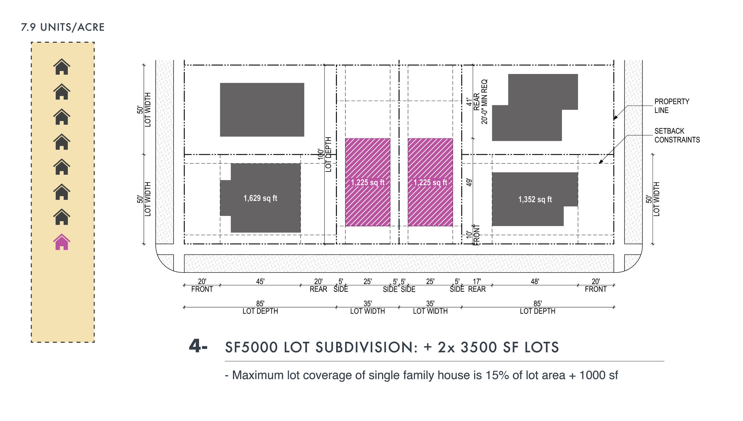
BLOCK-END OPPORTUNITIES
The following iterations to the right are feasible strategies for adding units based on lot conditions and zoning.
The major factors in land use code that determine building footprint* are lot coverage and yards for Single-Family zones, and FAR (floor area ratio) and setbacks for Lowrise zones.
*The building footprints represent general potential building area on the lot. They do not factor in design and modulation.
**In land use code, the distance between building structure and property line is called a yard in Single-Family zones and setback in Lowrise zones.